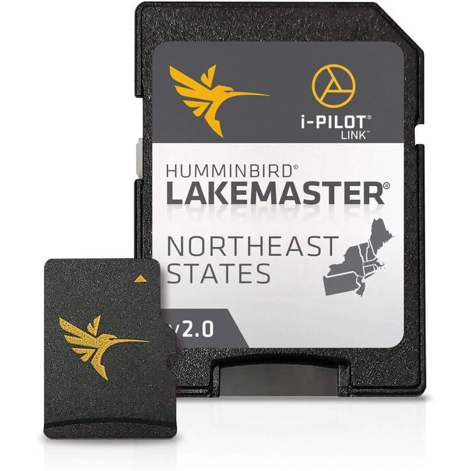
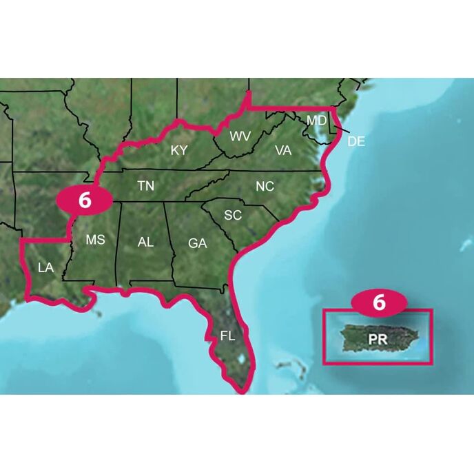
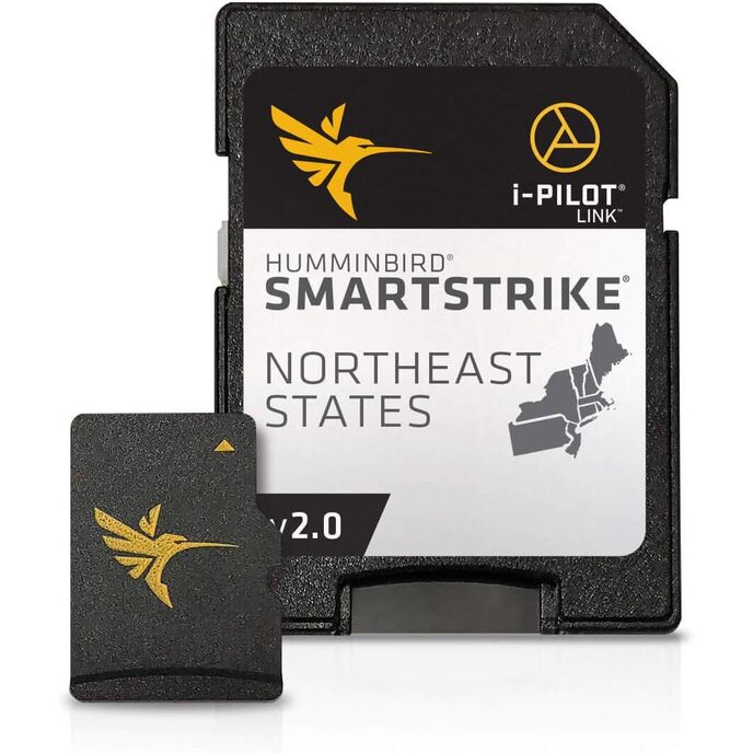
Οι ψηφιακοί χάρτες LakeMaster Plus διατίθενται σε κάρτα Micro SD (με συμπεριλαμβανόμενο προσαρμογέα κάρτας SD) που είναι συμβατή με όλα τα μοντέλα της σειράς HELIX, SOLIX, ONIX και ION που διαθέτουν GPS και με επιλεγμένα μοντέλα της σειράς 600-1100. Η ευδιάκριτη σκίαση τονίζει περιοχές με ρηχά νερά σε ρυθμιζόμενο εύρος έως και 30 πόδια, ενώ τα περιγράμματα βάθους και οι ακτές μπορούν να συγχρονιστούν με τα πραγματικά επίπεδα νερού λιμνών, δεξαμενών και ποταμών. Το LakeMaster Plus σάς δίνει τη δυνατότητα να προβάλετε μια επικάλυψη εναέριας εικόνας σε νερά υψηλής ευκρίνειας για να δείτε την είσοδο και την έξοδο των καναλιών του κολπίσκου, να δείτε πόσο εκτείνεται ένας ύφαλος ή μια γραμμή ζιζανίων και να διακρίνετε σωρούς βράχων ρηχών νερών, απότομες αποβολές και άλλα χαρακτηριστικά. Αυτή η έκδοση LakeMaster Plus Northeast States Edition, Version 2 διαθέτει περισσότερες από 130 λίμνες υψηλής ευκρίνειας και περισσότερες από 1.700 συνολικά λίμνες από PA, NJ, NY, CT, MA, VT, NH και ME, προσθέτοντας πάνω από 200 νέες λίμνες από την προηγούμενη έκδοση ( 27 σε υψηλή ευκρίνεια). Αποκτήστε ένα πρόσθετο πλεονέκτημα στη γωνία με τη χαρτογράφηση LakeMaster Plus, η οποία προσθέτει αεροφωτογραφία υψηλής ποιότητας στην απαράμιλλη ακρίβεια και λεπτομέρεια, ευανάγνωστα περιγράμματα, επισημασμένα εύρη βάθους και λίστες λιμνών με δυνατότητα κύλισης.
EAN: 0082324050046
Κατηγορίες Ηλεκτρονικά, Αυτοκίνητο & Οχήματα Ηλεκτρονικά, Ηλεκτρονικά Σκάφους, Marine GPS Chartplotters,
| Brand | Humminbird |
| Brand Name | Humminbird |
| Color | Black |
| Color | Black |
| Compatible Devices | all GPS-equipped HELIX, SOLIX, ONIX, and ION, 600-1100 Series models |
| Customer Reviews | 4.3 4.3 out of 5 stars 85 ratings 4.3 out of 5 stars |
| Fishing Technique | Any |
| Included Components | Includes micro SD card with full size adapter and water resistant SD card carrying case. |
| Included Components | Includes micro SD card with full size adapter and water resistant SD card carrying case. |
| Item Dimensions LxWxH | 8 x 6 x 2 inches |
| Item Dimensions LxWxH | 8 x 6 x 2 inches |
| Item Package Dimensions L x W x H | 7.4 x 5.39 x 0.63 inches |
| Item Weight | 0.29 Pounds |
| Item Weight | 0.29 Pounds |
| Manufacturer | Humminbird |
| Map Type | North America |
| Material | Plastic |
| Model Name | LakeMaster PLUS |
| Model Name | LakeMaster PLUS |
| Number of Items | 1 |
| Package Weight | 0.16 Kilograms |
| Part Number | 600045-4 |
| Screen Size | 27 Inches |
| Size | LakeMaster Plus |
| Sport Type | Fishing |
| Sport Type | Fishing |
| Style | LakeMaster Plus |
| Suggested Users | Unisex-Adult |
| Warranty Description | 30-day manufacturer |

€ 1515.55
€ 1515.55